
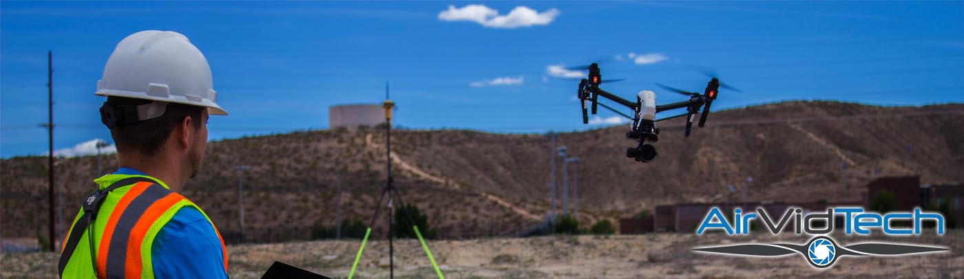
Professional Drone Consulting and Services
“Integrating drones has the potential to REDUCE COSTS while IMPROVING EFFICIENCY, ultimately saving millions of dollars” – Future of Drones in Business
High resolution models, topographies, mosaics, surfaces, maps, and video for analysis, production, marketing, and oversight
Professional hardware, software, training, and EXPERIENCE combine to provide cost savings and client specific solutions
Consulting for internal drone integration | Contract aerial scanning, modeling, and video services
About
AIRVIDTECH PROVIDES PROFESSIONAL CONSULTING FOR INTEGRATION OF DRONE AND sUAS SYSTEMS INTO EXISTING BUSINESS OPERATIONS AND WORK FLOWS
AirVidTech is a network of FAA authorized and licensed sUAS Commercial Operators which has been providing commercial services the last several years. As a professional consulting firm we are results focused, helping our clients improve efficiency and decrease costs through drone integration. We work to learn the specific needs of our clients in order to best direct them in selecting the most appropriate hardware and software solutions. Professional flight training and systems integration is essential as we aide our clients in taking full advantage of their drones and data. AirVidTech provides a full solution from the ground up for organizations of any size to realize the results and benefits of drones in their organization.
NEEDS
HARDWARE
SOFTWARE
TRAINING
INTEGRATION
RESULTS
Contact
Let's work on your project. Schedule a FREE initial consultation today.
contact@airvidtech.comAirVidTech.com
Why Hire AirVidTech
THE REGULATION, TECHNOLOGY, CAPABILITY AND EXPENSES RELATED TO DRONES CHANGES DAILY. NOT UNDERSTANDING THESE CHANGES COULD COST YOUR ORGANIZATION THOUSANDS OF DOLLARS.
When you are in need of professional financial advice or tax counseling you go to a CPA. When you need legal counsel you speak with a licensed attorney. When operating a drone for data gathering and aerial imagery, work with a UAS specialist. Our licensing, education, training, and experience enable us to direct and assist your organization in finding the right solution to meet your needs. Once that solution is determined we work with you side by side to integrate it into your workflow.


Services
LET OUR EXPERIENCE BE THE SHARPEST TOOL IN YOUR TOOLBOX
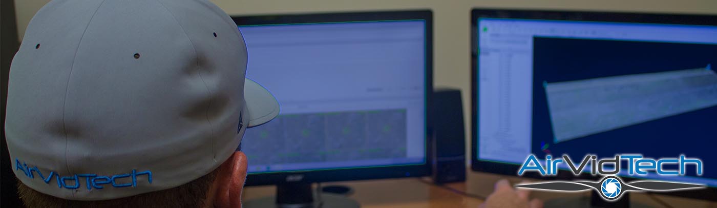
Having worked for and along side some of the largest commercial and industrial organizations in the mountain west providing topographies, point clouds, surface models, and high resolution 3D models, we are prepared to meet the needs of even the most technical job requirements. In addition to consulting we provide professional contract services for jobs as small as surface modeling of 3 acres with sub inch accuracy to high resolution modeling of large scale building construction and 300+ acre topographies. Very few jobs are outside our expertise or experience.
ENGINEERING
INSPECTION
CONSTRUCTION
RESOURCE MANAGEMENT
SURVEY
3D MODELING
VIDEO PRODUCTION
Past Work
3D Model of Kolob Canyon area in Southern Utah. This model was created from over 1,500 aerial images captured using two HD resolution cameras along 7 different flight paths. Images included nadir and oblique imagery which were tied together using over 20 manual tie points. This project was for a private client in preparation for a presentation to the BLM and National Wilderness Service.
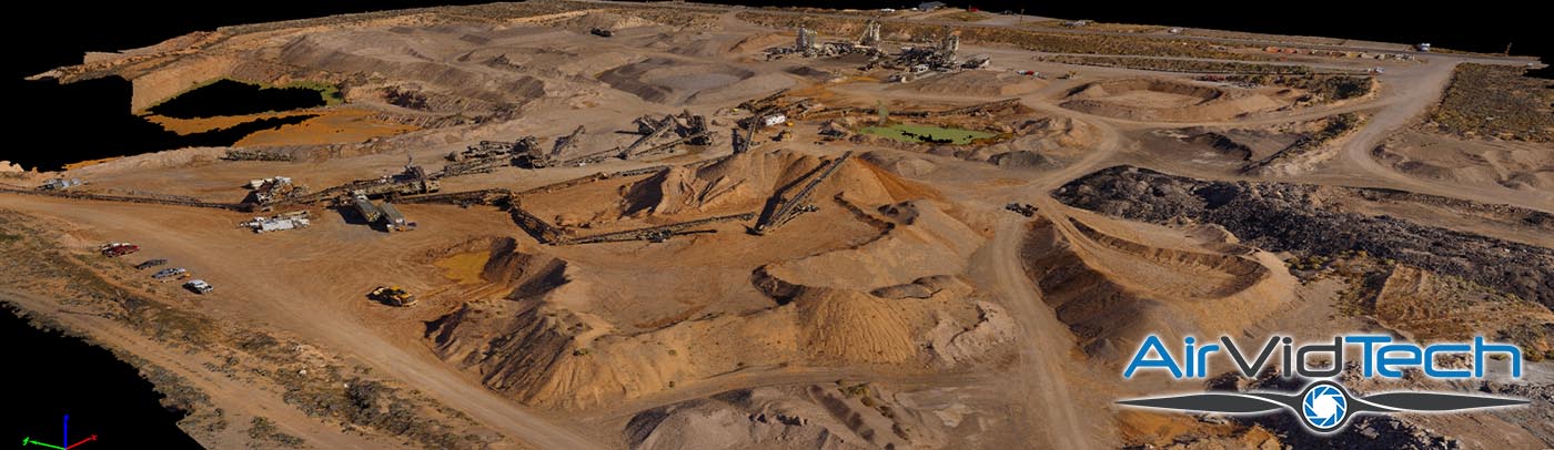
Aerial scan and surface model of Granite Construction mining operations. Interlocking flight patterns at two separate altitudes, capturing approximately 1,200 images, and incorporating a dozen ground control points enabled us to achieve sufficient accuracy to conduct analysis of material available in the quarry and stockpile volumes.
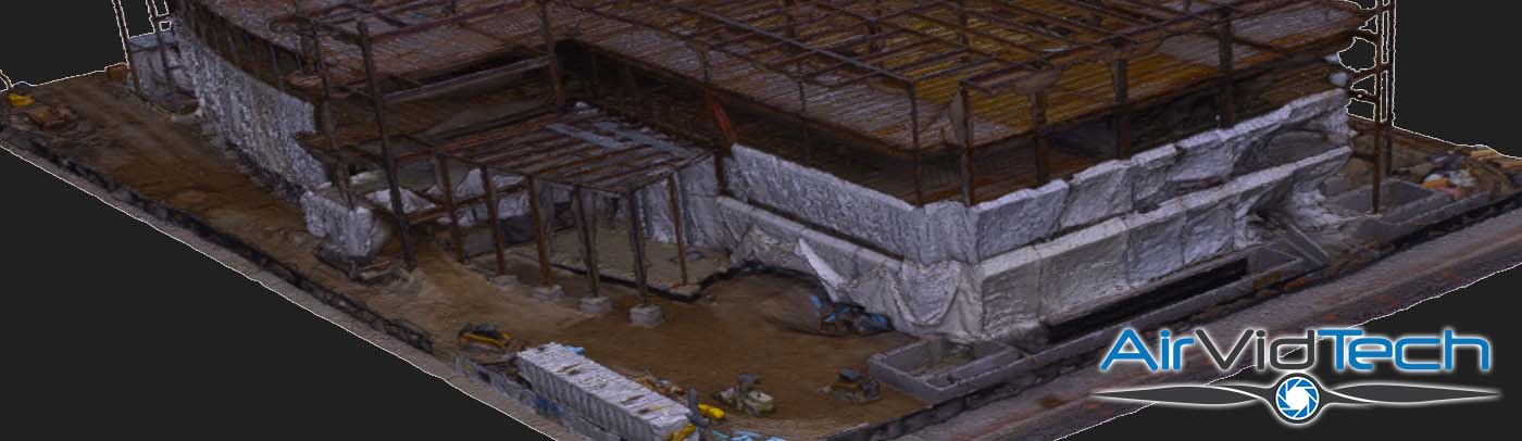
In conjunction with Steel Encounters Inc this model was created of the structural construction of a downtown high rise. This model was to demonstrate the capabilities of structural modeling in identifying material errors preparatory to subsequent building phases. With High Resolution cameras and precision piloting sub inch accuracy and inspection can be performed.
Licensing
ALL LICENSING LISTED BELOW IS AVAILABLE FOR REVIEW ON FAA.GOV AND ALL PROOF OF INSURANCE IS AVAILABLE UPON REQUEST
Section 333 Exemption
Certificate of Authorization
Commercial Pilot Certificate
Certificate of Authorization
Commercial Pilot Certificate
Part 107 Certificate
KSGU Airspace Authorization
Night Flight Waiver - PENDING
KLAS Airspace Authorization - PENDING
KSGU Airspace Authorization
Night Flight Waiver - PENDING
KLAS Airspace Authorization - PENDING
General Liability - $1M
Professional Liability - $1M
UAS Liability - $1M
Photography - $1M
Commercial Vehicle - $1M
Professional Liability - $1M
UAS Liability - $1M
Photography - $1M
Commercial Vehicle - $1M